


Know Your Nature Parks - Autumn 2025
As we head into autumn, the shorebirds breeding season comes to an end on Phillip Island (Milawul). Parent birds may still be sitting on eggs or with growing chicks; however, many pairs begin forming winter flocks and, along with their fledglings, may move off the island.
Many of our species are now preparing for migration. Some shorebirds (waders) that use the East Asian-Australasian Flyway can be seen across low-tide mudflats, frantically feeding in preparation for their mighty long-distance flights to breeding grounds in the Northern Hemisphere.
Read on to find out about our breeding season achievements and what’s happening at Phillip Island Nature Parks.
In The Skies – Birdlife
Fairy tern success for Phillip Island (Milawul)
The first sightings of the fairy terns (Sternula nereis) for the season were in early November along the Phillip Island (Milawul) Ramsar wetland. Around 25 individuals were roosting by the water’s edge, showing early signs of courting and prospecting the site.
Early-stage management was deployed to reduce the impact of disturbance while the birds begin to establish nest sites and numbers at the site gradually increased to over 100 individuals. In mid-December, we were excited to see the first eggs for the season and two nesting sites in the colony.
Due to high tides, eight eggs across six nests were washed away on the sandy spit nesting site. However, the dune nesting site continued to thrive, with 78 eggs recorded over 40 nests, including one unusual nest with four eggs. In total, 136 eggs were documented across 69 nests.
This successful breeding season is a result of many hours spent by the Nature Parks and Bunurong Land Council Aboriginal Corporation staff and volunteers with at least 65 birds fledged. This project is supported by the Nature Fund of the Department of Energy, Environment and Climate Action and the Penguin Foundation.
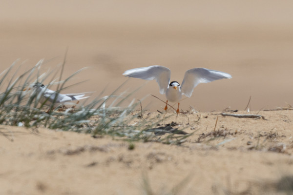
Image 1: Fairy tern preparing to fly.
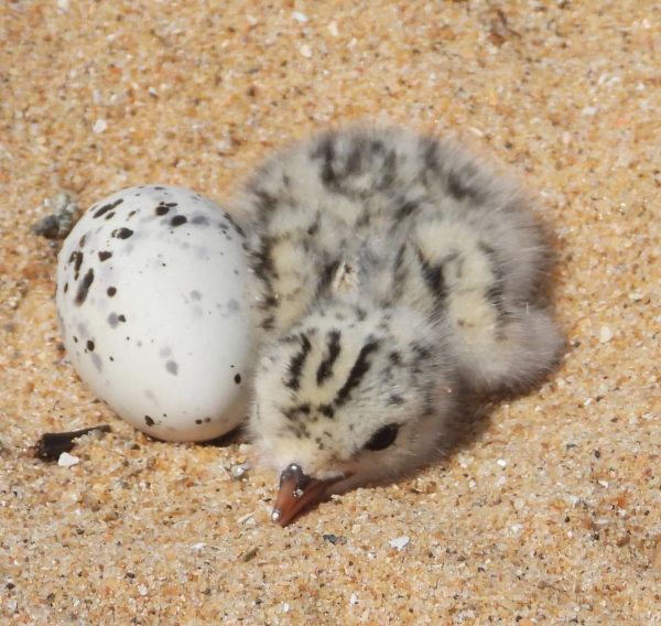
Image 2: Fairy tern chick and egg.
Hooded plovers
Hooded plovers (Thinornis cucullatus cucullatus) are categorised as Threatened in Australia under the Environment Protection and Biodiversity Conservation Act 1999 and Vulnerable in Victoria under the Flora and Fauna Guarantee Act 1988. To help the hooded plover throughout the 2024-25 breeding season, staff and volunteers carefully monitor nesting sites and collect vital data. When eggs are found, a simple nest refuge is made, complete with signage, rope fences and in some location's chick shelters and nest monitoring cameras.
The ‘Sharing our Shores’ campaign continues to raise community awareness about the importance of working together to protect vulnerable species like the hooded plovers and the natural environment. So far, the 2024-25 hooded plover breeding season on Phillip Island (Milawul) has shown pleasing results with 10 fledglings from 17 pairs by early March, with a few more chicks to go.
The dedication of the ‘Hoodie Team’ made up by volunteers, the Nature Parks and Bass Coast Shire Council staff, Deakin intern students, Department of Energy, Environment and Climate Action Conservation Regulator Officers and the community is paramount to the protection of these tiny yet mighty birds.
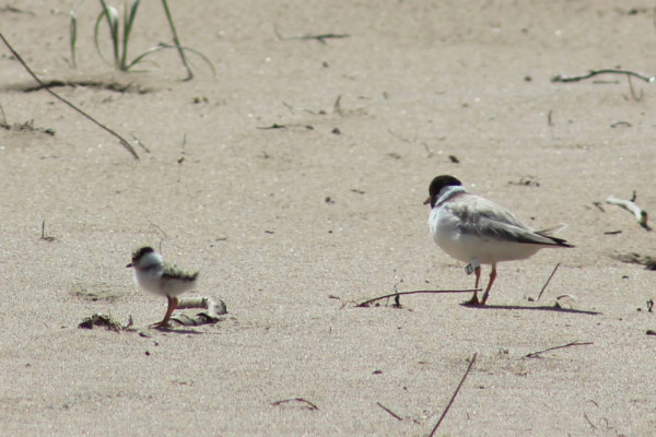
Image 3: Hooded plover banded adult and chick.
Observation Point
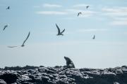
Western Port is an internationally significant Ramsar site, providing crucial habitat for numerous resident and migratory shorebirds. ’Western Port, listed by both UNESCO and Ramsar, is a globally significant area for biodiversity conservation. As a vital part of the Ramsar wetland network, it provides critical habitat for numerous threatened species, including the Eastern curlew and curlew sandpiper.
Observation Point and Rhyll Inlet, situated on the northern coast of Phillip Island, serve as vital areas for high tide roosting and foraging. These areas support a diverse array of species, including the Critically Endangered Eastern curlew (Numenius madagascariensis), Critically Endangered curlew sandpiper (Calidris ferruginea), Endangered bar-tailed godwit (Limosa lapponica) and Endangered common greenshank (Tringa nebularia).
Partnerships are essential in advancing our shared goals of habitat protection, research and sustainable development. The Nature Parks, in collaboration with the Bunurong Land Council Aboriginal Corporation, conducts regular seasonal surveys to monitor shorebird populations at Observation Point. These efforts are enhanced by the use of remote cameras, conservation dogs, surveys and compliance ranger patrols. Such measures are integral to mitigating threats posed by invasive weeds, introduced predators and human disturbance.
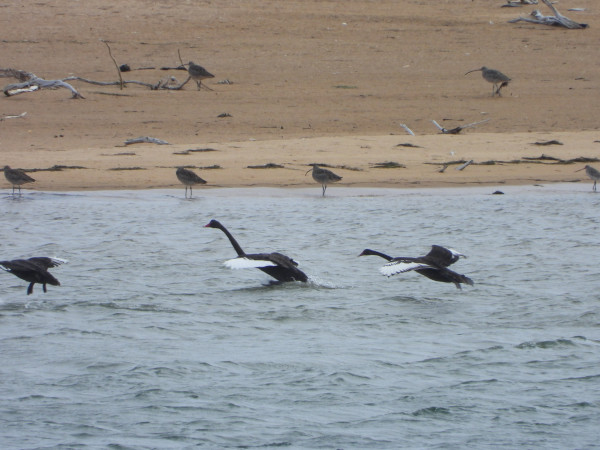
Image 4: Eastern curlews and black swans at Observation Point.
In The Water
Reflections from Seal Rocks
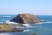
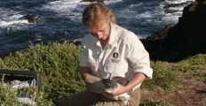
Dr Rebecca McIntosh is leading the ‘Lost at Sea: Conserving Cultural Heritage and Fur Seals’ research project. Scientists visiting Seal Rocks have observed erosion and high pup mortality, possibly caused by altered weather conditions and rising sea level. This project will use LiDAR drone surveys and tide and wave data loggers to measure erosion and ocean inundation; temperature loggers will monitor heatwaves; and Archaeologists will assess the cultural heritage at Seal Rocks. This research is a collaborative effort between the Nature Parks, the Bunurong Land Council Aboriginal Corporation, Monash University, and Wildlife Coast Cruises, with funding from the Telematics Trust and Penguin Foundation.
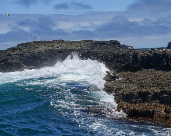
Image 5: Seal Rocks
During a visit to Seal Rocks on 21 January 2025, the team observed three active entanglements (two involving fishing line and one with a green trawl net) and re-sighted three seals previously studied in research. These seals are part of a project with Monash University comparing the behaviour of individuals released from entanglements with healthy, unaffected seals of the same sex and size, using movement trackers. All three appeared to be in good health and body condition following tracker deployments earlier this year.
As part of the ‘Lost at Sea’ project, the team also retrieved four and deployed six temperature logging devices at Seal Rocks to monitor heat waves. Now in its early data collection phase, this three-year project aims to provide critical insights into the changing marine environment.
Our state-of-the-art research program provides us with evidence that our marine environment in the Bass Strait is changing rapidly, and if we want seals and other species to flourish on Phillip Island for future generations, we must respect this beautiful ecosystem, make better consumer choices, and support healthy ocean activities.
Support Your Nature Parks
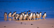
Short-tailed shearwaters
Autumn marks the departure of short-tailed shearwaters as they begin their long flight to the Bering Strait near Alaska. Starting with a trip south to feed in the nutrient-rich waters around Antarctica before heading north. They leave their fat, fluffy chicks behind in the burrows where they lose weight and grow their adult flight feathers. By late April or early May, the chicks will also embark on their first migration.
Please support the shearwaters’ incredible 15,000 km migration by:
- Turning your outdoor lights off in the evening
- Considering using wildlife sensitive lighting at home
- Driving slowly and be cautious on the roads
If you find an injured shearwater, please call the Wildlife Victoria hotline 24/7 on 03 8400 7300.
For the Locals
Forrest Caves
Forrest Caves beach access stairway, car park and toilet are currently closed due to the construction of the new northern stairway. Access to the beach remains available for beachgoers via the nearby Bruce Avenue access track. To minimise environmental impact, a helicopter was used to lift 21 loads of material in just 55 minutes! Limited work will be undertaken during the short-tailed shearwater fledging period.
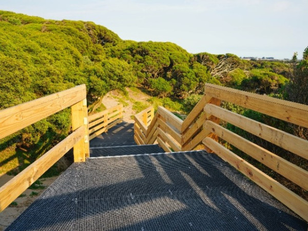
Image 6: New boardwalk section at Forrest Caves.
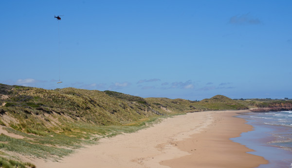
Image 7: A helicopter delivering material to the work area.
Cowes-Rhyll trail
The Phillip Island Nature Parks and Bass Coast Shire Council are working in partnership to upgrade the Cowes-Rhyll trail to provide a safe and accessible shared path between the two townships.
Stage 3 upgrades are underway throughout March 2025 encompassing the section of trail between Conservation Hill car park and McIlwraith Road, Rhyll.
Upgrades include:
- Improved connection between the townships of Cowes and Rhyll.
- A shared use pathway for pedestrians and cyclists.
- Upgrades to existing gravel trail and sections of the management track.
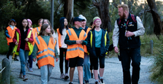
Penguin Parade boardwalks and viewing stands project
In December 2024 the project team consisting of Simpson Construction and Terroir Architects successfully completed stage 1 of the project, providing a new DDA compliant all accessible looped boardwalk, an upgrade to Penguins Plus viewing platform and a new and improved Penguins Premium Platform.
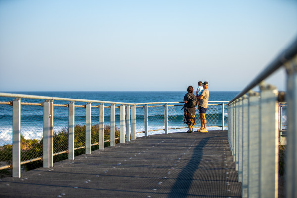
Image 8: Visitors arrive at the Summerland Beach on the new Shearwater Boardwalk.
Stage 2 of the project is due to commence in April 2025.
For more information, please visit this page.
Churchill Island
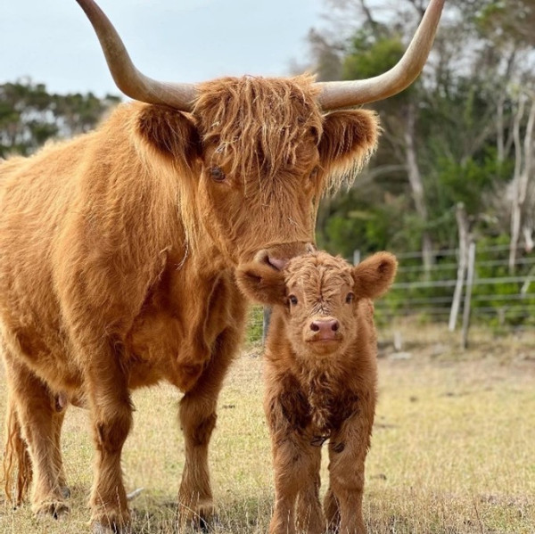
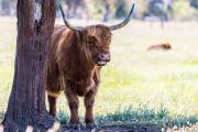
Image 9: Highland cow and calf at Churchill Island.
The cutest time of year is here again! Our highland cows are calving, and we currently have three adorable calves at Churchill Island.
Keeping wildlife wild
The greatest thing you can do for wildlife is to keep it wild. Please always maintain a safe distance and remember how lucky we are to be able to share our beautiful island home.
Subscribe to our Conservation News for more in-depth coverage.
Share Your Nature Parks
Don't forget to share images with us by using our hashtag #PhillipIslandNP